Missouri GIS Timeline
A Timeline of GIS in Missouri State Government
Based on information provided by Tim Haithcoat, University of Missouri, and Tracy Schloss, formerly with the Missouri Office of Geospatial Information. This version is lightly edited for readability and additional content.
1977 – Professor Chris Johannsen leads the Missouri Interagency Project, a collaboration between the University of Missouri, the U.S. Department of Agriculture, and the Missouri Department of Natural Resources. While focusing remote sensing analysis, it is an early example of interagency and academic geographic data collaboration in Missouri.
1980 – Chris Johannsen and Terry Barney create the Geographic Resources Center (GRC) at the University of Missouri. The GRC conducts research projects, and is a resource for entities that need assistance with mapping and geospatial analysis projects.
1988 – Missouri departments of Transportation (MoDOT), Natural Resources (DNR), and Conservation (MDC) purchase their first GIS licenses (from Esri) and begin transferring what were then paper documents and maps into electronic versions.
1989 – An informal group of interagency GIS professionals is formed, creating a GIS Cooperative made up of interested parties from state and federal agencies and academic intuitions. Then Governor Ashcroft designated DNR as the lead agency for GIS. A DNR staff person, John Finley, served as Chair of this group until 1990, when his position was vacated.
1991 – The University of Missouri became more involved with state government GIS implementation through the GRC. The Cooperative was re-organized into MOSAIC (Missouri Systems Access & Information Consortium). The Consortium is opened up to both public and private GIS users. This group decides to form itself as a more formal organization.
1993 – A small task force is created to develop a strategic plan advocating a coordinated state-wide approach to GIS in Missouri.
1994 – Discussions of funding this approach, and how/where this fit into the state’s budget. In Fiscal Year 1994, MoDOT and MDC committed funds toward implementation of the 1993 strategic plan. The task force presents the strategic plan to the Governor.
1995 – Governor Carnahan establishes the Missouri GIS Advisory Committee with many of the task force participants becoming its original members.
Missouri budgets $158,000 for GRC to develop a clearinghouse for GIS data. Funding was organized through a line item budget for the University of Missouri. The funding is to be used to “…develop a clearinghouse for information on use of GIS systems and on those public data bases available.” and “…to improve the quality and efficiency of state governmental services and decision making through wider application of improved GI.”
With these funds, GRC creates the Missouri Spatial Data Information Service (MSDIS). MSDIS acts as the state clearinghouse for GIS data to the present time.
The State creates an Office of Information Technology (OIT) and Information Technology Planning Board (ITPB).
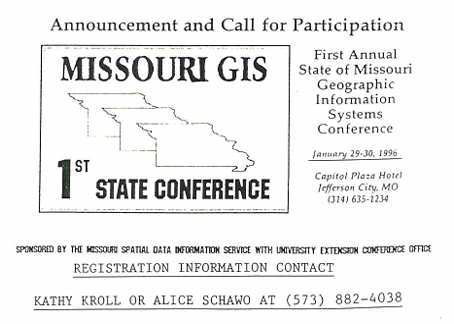
1996 – The First Missouri GIS Conference is held in January at the Capitol Plaza Hotel in Jefferson City.
Chief Information Officer (CIO) Benson in OIT reviews a plan for strategic planning for MSDIS. Following review of this plan, a more formal organization, the Missouri GIS Advisory Committee (MGISAC) was created, replacing MOSAIC.
MGISAC is recognized as a standing committee under the CIO, within the Office of Information Technology. The Committee reports through the CIO to the ITPB. The first chair of MGSIAC was the State Demographer Ryan Burson, from the Office of Administration Budget and Planning.
The MSDIS budget is incorporated into the base budget of the University of Missouri.
2001 – Department of Natural Resources hires a full time GIS Coordinator, with the job of advancing GIS utilization throughout that department. Full time GIS staff are hired in the Department of Health and Senior Services.
2002 – GIS job classifications are created. Various staff in the Department of Health and Senior Services (DHSS), Department of Economic Development (DED), Missouri Department of Agriculture (MDA), and DNR were reclassified to GIS positions. GIS development is largely in the form of data creation to support specific business needs.
2003 – The Missouri GIS Advisory Council web site, previously part of the MSDIS web site, is officially launched as an independent website in May at https://MGISAC.org.
2005 – 2008 – GIS expansion in multiple agencies is happening independently, with no central resources for overall coordination.
Due to concerns of federal funding requirements, Missouri designates a series of mostly state employees who use the title Geographic Information Officer (GIO). However, the title is not associated with any full-time position, with designated persons serving in the role in addition to other job responsibilities, including Ryan Lanclos, Tony Spicci, and Tim Haithcoat. The primary duty of these split-position people is to create a GIS strategic plan for Missouri.
A Missouri GIS Strategic Plan, largely focusing on securing staff, funding and authority to carry out GIS coordination across the state, evolves over this time period. It includes a standard definition of job duties for a GIO based on those in other states. Several versions of the strategic plan were written as a collaboration between these GIOs and members of MGISAC.
A 2011 version of the plan is available on the Office of Administration web site as Mapping Missouri’s Future.
2009 – Missouri begins creating a consolidated IT infrastructure. IT professionals from various state agencies form the basis of the Information Technology Services Division (ITSD). ITSD is placed within the Office of Administration (OA). This impacts 14 of Missouri’s 16 Executive Agencies.
Two agencies have their own revenue and are not included in the consolidation: Departments of Transportation and Conservation (MoDOT, MDC), along with some programs within Dept. of Public Safety (Highway Patrol). Consolidation only impacts executive agencies. Non-executive agencies (Secretary of State, State Tax Commissioner, Auditor among others) are not included.
2010 – The Federal government decides not to withhold funds to states without a GIO. This removes the immediate need to confer this title to someone in our organization. (Year approximate.)
2011 – IT consolidation reaches the GIS professionals, creating the Office of Geospatial Information (OGI). This team provides GIS support through the consolidated agencies, including server support, GIS data management, and GIS project development.
The head of this Office is given the title, Director of GIS, not the title GIO. The nomenclature “Director” is used throughout ITSD, as the title for the heads of each functional areas. At the time, ITSD have just one “Officer” position, the CIO.
The “C” in MGISAC, changes from Committee, to Council, making it the Missouri GIS Advisory Council.
The 2011 version of the GIS Strategic Plan removes references to a GIO, replacing this with “Office of Geospatial Information”. Duties and authorities recommended from the 2008 version are still present, now as OGI rather GIO.
The 2011 plan changes focus to prioritize on agency business needs. References to general oversight of MGISAC and MSDIS are removed. Both versions have the statement “The MGISAC operates under and reports to the CIO within the Information Technology Services Division (ITSD).”
2012 – Besides creating a Director position, one additional staff is added to the group of GIS professionals transferred from other agencies, bringing the total staff of the Office of Geospatial Information to fifteen.
OGI has a budget, but with a focus prioritized on supporting state agency’s needs. Funding for OGI work is aligned with agency specific requests, with some core funding to support the server infrastructure.
The majority of OGI staff continue to be funded through the agencies where they were originally placed. The projects they work on are aligned with this funding. 7 of 15 are funded to support DNR.
There are large GIS foot prints in Departments of Transportation and Conservation. These agencies continue managing their own GIS needs in-house.
The majority of GIS work within OGI is in support of DNR, DHSS, and the Department of Public Safety (DPS). The emphasis is on the conversion of specific business workflows that need a spatial component into one that works within the Esri environment.
2013 – A proposed executive order was drafted by Director of GIS, Paul Wright to define the Missouri GIS Advisory Council through this channel, but never adopted.
2016 – Tracy Schloss becomes the Director of GIS for Missouri.
2017 – 2019 – Growth continues in the same agencies that have traditionally utilized GIS, both inside and outside a consolidated IT. Agencies like DNR and MDC grow enough to enter into Enterprise License Agreements (ELA) with software vendor Esri.
2020 – The National Geospatial-Intelligence Agency (NGA) offers Missouri a Legislative Fellow to assist with the expansion of GIS throughout the state. The goal for the year is to gather information from states that have implemented their GIS as a state-wide resource, and present those finding in summary. COVID hampers these activities.
2021 – The National Geospatial-Intelligence Agency (NGA) offers Missouri a second Legislative Fellow to assist with the expansion of GIS throughout the state. Efforts are spent crafting a Project Charter and Business Case to support a New Decision Item (NDI) for GIS expansion. The project passes the Cabinet IT Governance Council, but does not make the Governor’s recommendation for the budget, submitted by the legislators.
2022 – Following COVID and with the release of American Rescue Plan Act (ARPA) from the federal government, millions of dollars are allocated by the State for GIS data. The majority of the investment is for aerial imagery, broadband, NG911, flood plain management, elevation derived hydrography (EDH).
2023 – HB 475, companion bill SB 653 is proposed to codify the Missouri GIS Advisory Council. The legislation includes not only official recognition of the Council, but also defines responsibilities of the Council. It includes functions already managed by the Office of Geospatial Information, an office specifically created at the recommendation of MGISAC to perform these duties. The legislation does not pass.