Champions of GIS
2025
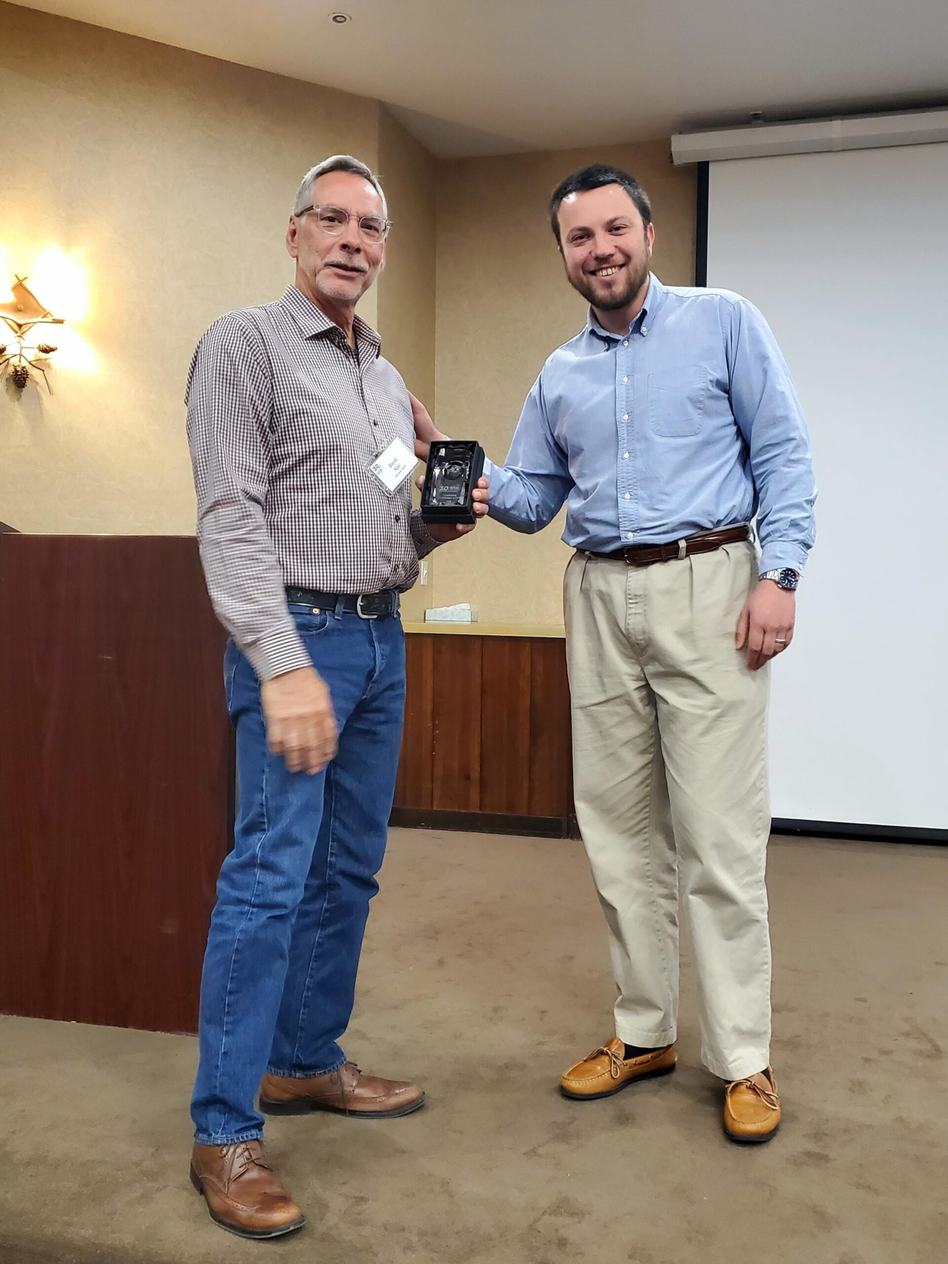 The 2025 Outstanding Contribution to GIS Award was presented to David Nail (left in photo) by MGISAC Chair Zackary Becker. David recently retired from the United States Geological Survey (USGS) after a successful 36-year career. He was the USGS Liaison to Missouri and served as an ex-officio member of the Missouri GIS Advisory Council. David was an active member of the MGISAC Data Development Committee and has helped form partnerships that resulted in the collection of lidar and Elevation Derived Hydrography in Missouri. David’s efforts have resulted in the creation of data resources that are accessible to the public and used in a variety of business cases. David was also an active and willing supporter of the broader GIS community. For these reasons, David Nail is the recipient of the 2025 Outstanding Contribution to GIS award.
2023
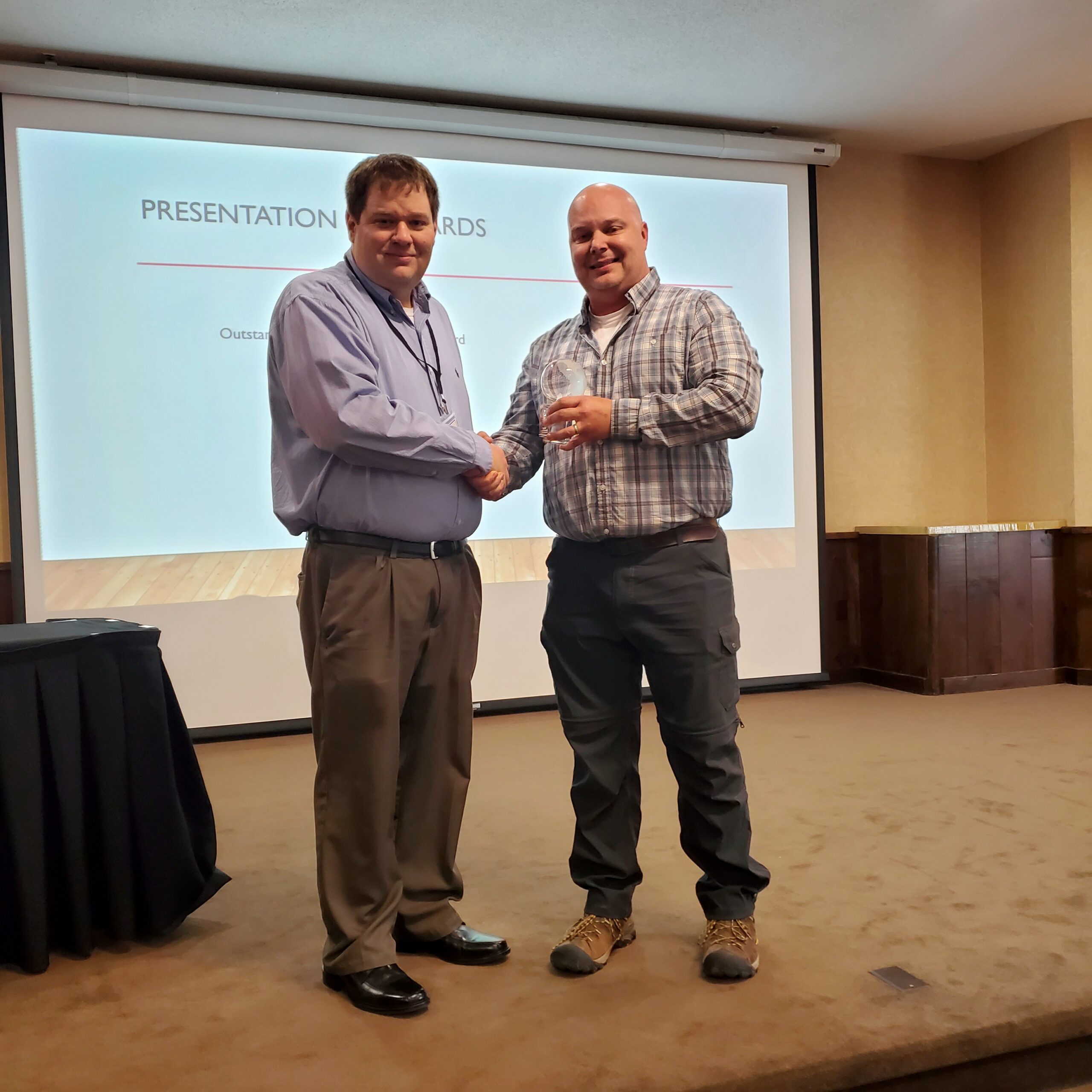 The 2023 Outstanding Contribution to GIS Award goes to Tim Bixler (left in photo) with the Missouri Department of Conservation by MGISAC Chair Nathan Mattox. Tim’s role in championing statewide imagery acquisition in 2022 resulted in a cooperative project (with Missouri Department of Natural Resources and Missouri Department of Transportation). This project acquired half of the State with 1-foot resolution leaf-off imagery, a product that had not been accessible to State-level programs. Additionally, Mr. Bixler has been a cooperative project participant in the 2023/2024 imagery acquisition with the Missouri 911 Board and Missouri Department of Natural Resources, which is in contract to acquire the entire State of Missouri in 6-inch leaf-off imagery in years 2023 and 2024. Mr. Bixler has been involved in additional cooperative projects throughout the State, leading to an unprecedented amount of acquired data that will be available to the public. Mr. Bixler is also involved in efforts to revise the National Wetlands Inventory and modernize hydrographic dataset creation through the Elevation Derived Hydrography project. On top of these accomplishments, Mr. Bixler has been elected to be the next Chair of the Missouri GIS Advisory Council, demonstrating his acknowledged leadership to the Missouri GIS Community. It is because of these reasons that Mr. Timothy Bixler is the recipient of the 2023 Outstanding Contribution to GIS Award.
2021
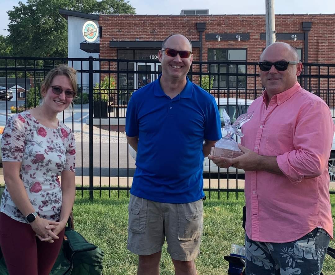 Tony Spicci (right in photo) was presented the 2021 “Lewis and Clark Award” for his exceptional service to the development and success of MGISAC by Jennifer Bowden and Colin Duewell. Tony was one of the founding members of MGISAC, has been active at multiple levels for all these years, has chaired the council multiple times, been a leader of efforts to organize and plan multiple conferences, and has been instrumental in multiple efforts for funding orthoimagery and the formation of the NAIP program. He has also served as NSGIC Liaison and with MAGIC for many years.
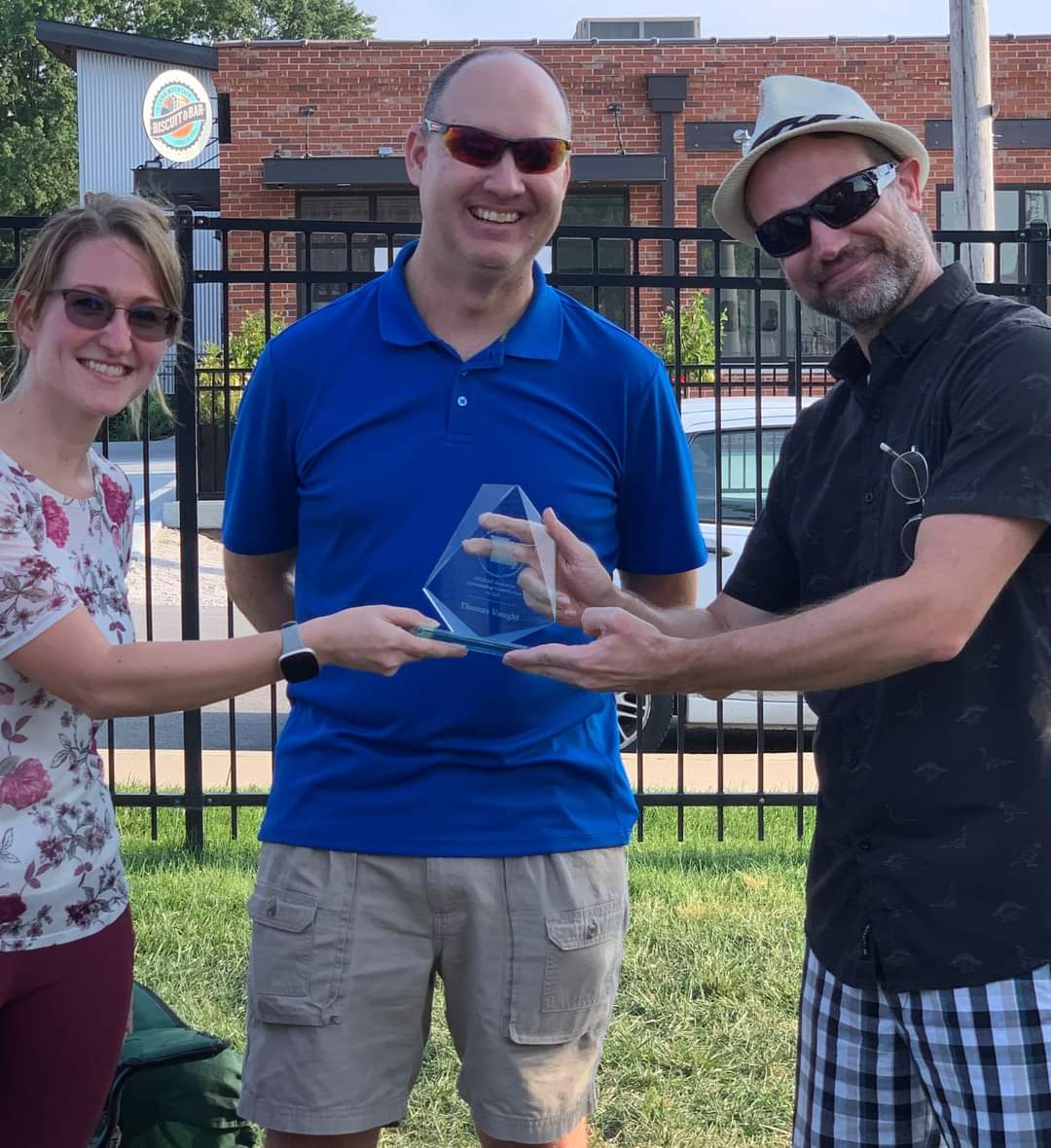 The “Outstanding Contribution to GIS Award” was presented to Thomas Vought (right in photo) by Jennifer Bowden and Colin Duewell. Tom has done an outstanding job of managing, maintaining and coordinating all activities on and around the Missouri Spatial Data Information Service (MSDIS) site and its contributors. Tom has provided the most thorough oversight of MSDIS data warehouse while modernizing the platform to make it more relevant and user friendly. Tom pivoted to run MSDIS from his house during COVID in 2020 while managing to curate data and continuing to build relationships. Tom goes above and beyond on every request sent his way and brings an infectious enthusiasm to the position – that is a breath of fresh air. He has also lent his expertise and resources to MGISAC time and time again and enabled us to continue smoothly with virtual meetings during the pandemic. In addition to all that he gives to MSDIS and MGISAC, he represent Missouri in the MAGIC data clearinghouse committee all while he continues his job roles and responsibilities in education at the University of Missouri.
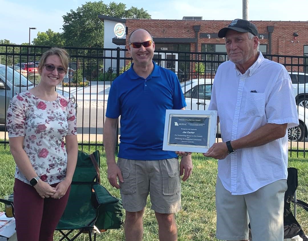 With great appreciation, Joe Carter was presented the MGISAC Service award. Joe has been an active participant in MGISAC for about 9 years as a representative for MoDOT. He served on several committees during that time. Serving as the chair of the by-laws committee, Joe thoroughly reviewed and made recommendations as our organization experienced growth and change. His eye for detail has been an asset to MGISAC. Joe also served as an Education committee chair for several years. One of his biggest contributions to the field of GIS has been in education. He has volunteered many hours to share his passion of geography with kids, whether it be helping with a workshop, or judging a geography contest. He was also active with the Missouri GIS conference as well, helping plan, presenting, and chairing the conference poster contest. Thank you, Joe!
2019
 Melissa Johnson, the GIS Manager for Cole County, Missouri, in many ways exceeded the expectations for this award for her Outstanding Contribution to the GIS community and our state. Melissa has been a very engaged and active member of MGISAC since the day she joined the Council. Her dedication, intelligence, and accomplishments complement our worthy past recipients and make her highly deserving of this award. Melissa has gone out of her way countless times in helping the GIS community in Missouri. Her past service to the Missouri Mappers Association while at the same time devoting her many talents and leadership to MGISAC’s council and its many past conferences is an impressive example of her years of “Outstanding Contributions to GIS”.
2017
Colin Duewell, our Department of Economic Development GIS Specialist, for his Outstanding Contribution in Communication and Collaboration to the GIS community and our state. As the one GIS professional for a 900+ employee department that analyzes business and workforce development issues, his work has been critical to advancing Missouri’s efforts to strengthen our economy.
His daily work requires not only a strong set of GIS skills but the equally important ability to communicate spatial data to the policymakers, planners, and the general public. Much of our work in economic and workforce analysis requires strong collaboration and impacts the decisions of job seekers, businesses, and community leaders so having a keen sense of how to communicate complex geographic data is vital to our efforts. I have been privileged to be Colin’s colleague for over a decade and, while his body of work is too vast to catalog in one place, I’d like to highlight a few products that showcase his strong communication and collaboration skills:
Workforce Area Migration Briefs (October 2016):
Colin gathered and analyzed a complex set of IRS migration data that is difficult to visualize regionally in a way that communicates the bottom line of the movement of people into and out of a region. These reports show the migration of households outward from urban cores but also the attraction of large metropolitan areas for more rural regions.
Workforce Development Area Commuting Profiles (March 2016):
Colin used spatial analysis to develop heat maps of employee location data, a fantastic way to show worker movements and how interconnected our local economies are.
Economic Analysis of Casino Applicants for Missouri’s Gaming License (November 2010):
This is an older example highlighting some of Colin’s contribution to our efforts but is important to understand his depth of communication and GIS talent over the years he has worked in the Department of Economic Development. Colin developed excellent maps to visualize the issues and, more importantly, helped develop the gravity model analysis needed to evaluate business sales displacement. I also highlight this report because it received an national research award in 2011 from the Council for Community and Economic Research and showcases Colin’s long-term impact to the department as a great communicator and collaborator.
These examples are the tip of the iceberg in terms of GIS contributions Colin makes on a daily basis to the department and its many stakeholders. Most of our regular reports demonstrate his GIS influence and can be found at www.MissouriEconomy.org. From unemployment maps to heat maps of workers impacted by a layoff, Colin is constantly creating well-communicated spatial analysis and mentoring others in this office with basic GIS skills. He is an excellent leader to our staff and a great hands-on practitioner highlighting the power of GIS to make better decisions.
2015
At the 2015 Missouri GIS Conference, the Missouri GIS Advisory Council Chair Amber Reynolds presents the “Outstanding Contribution to GIS” award to Mike Fonner, GIS Manager, City of Springfield, Mo.
Mike has been a champion and driving force for GIS for Southwest Missouri, and specifically the Springfield/Greene County area since the early 1990’s. His insight and initiative have been the foundation for a solid multi-agency GIS consortium, where project and technology ideas are openly shared. He doesn’t hesitate to shares tools, processes, training opportunities, documentation and data products that are a result of his group’s efforts. With his leadership, the City of Springfield built a powerful GIS by digitizing the Greene County Assessor’s Tax Maps, which were then shared with Greene County and City Utilities. In the early days there were just a couple of people building their GIS. Today, Mike has a team of dedicated, long term GIS professionals that he has mentored and supported in their growth as well. One example of Mike’s extensive list of multi-agency efforts has been his work to coordinate and manage the aerial photography flight contracts and LiDAR cost share programs all these years. These programs have allowed organizations to procure better quality images than they would have been able to do with their own budgets.
2013
 At the 2013 Missouri GIS Conference, the Missouri GIS Advisory Council Conference Committee Co-chair Andy Wagner (right in photos) presented awards to Mark Duewell (left photo) and Jason Warzinik (right photo).
Mark Duewell – Senior GIS Specialist MU Geographic Resources Center, was awarded the “Lewis and Clark Award – Forging New Frontiers in GIS in Missouri” for his tireless promoter of the MGISAC and his contributions leading Missouri GIS through his work at MSDIS. He organizes the highly successful regional conferences and workshops, manages the list serves, has been a conference committee member for each conference, and is a member on many standing committees. Mark has successfully applied for and received a number of grants used for training local GIS technicians, began the structures project, trained people on metadata, and coordinated the agreement with Washington University making Lidar data available for all. His leadership of MSDIS has led to many improvements, along with Tim Haithcoat MSDIS provides more services then can be expected from their limited budget.
Jason Warzinik is the GIS Manager for Boone County MO and was recipient of the “Outstanding Contribution to GIS” award. Jason as made remarkable contributions as the GIS Manager for Boone County over the past nine years and willingly shares his talents and expertise with other people and organizations. He has greatly expanded and improved GIS services and capabilities in the county and mid-Missouri area through his dedicated work with organizations such as the Shared GIS Consortium, MGISAC, and Region F GIS Coordinators. He has developed and integrated over two dozen GIS Web applications that are widely used by Consortium members and the public. Jason was also instrumental in organizing and providing leadership for the Region F GIS Coordinators group as they worked to build a GIS foundation that could be used as a common operating picture during local and regional disasters and aid with dispatching and mutual aid requests to surrounding Counties within Region F.
2011

At the 2011 Missouri GIS Conference, the Missouri GIS Advisory Council Chair Elizabeth Cook (center) presented awards to Ray Fox (left) and Andy Wagner (right).
Ray Fox, USGS Geospatial Liaison for Missouri, was awarded the “Lewis and Clark Award – Forging New Frontiers in GIS in Missouri” for his sustained contributions leading Missouri GIS. Since becoming Missouri’s liaison in 2002, Ray has fostered over $500,000 of Federal dollars for GIS capacity building in Missouri. He is an unsurpassed leader in the Missouri GIS Advisory Council, serving as Vice-Chair, head of the Data Development Committee, and coordinator and presenter at countless workshops and collaborative meetings. Ray is a true champion of GIS who always has a smile on his face and a “can do” attitude.
Andy Wagner is the GIS Coordinator for Maryland Heights, MO and was recipient of the “Outstanding Contribution to GIS” award. Andy managed the 2010 St. Louis County Imagery Consortium, a regional collaborative acquisition of aerial photography that had been attempted in the past but was finally successful due in large part to Andy’s belief in the value of collaboration and his leadership style.