Data Development
Promoting the development and accessibility of GIS data in Missouri
Mission:
The committee’s focus is to assess the geospatial data needs in the state of Missouri, develop plans of action to meet those needs, and work to ensure that the data meets those needs. The data development committee is committed to making all geospatial data discoverable and available to the general public through the State’s spatial data clearinghouse.
Missouri Data Development Initiatives:
Background:
The Data Development committee is primarily concerned with the framework data themes as defined by Federal Geographic Data Committee (FGDC), and by the MGISAC. The federal data themes include: Orthoimagery, Elevation, Cadastral, Transportation, Hydrography, Administrative Boundaries, and Geodetic Control. The Missouri data themes include Geology, Land Cover, Soils, and Critical Infrastructure.
To encourage the development and maintenance of the geospatial data, the committee will identify and support data stewards for those framework data themes and seek opportunities for partnerships to advance and sustain these efforts.
The Data Development committee held its first meeting on July 8, 2008 to facilitate discussions about data development efforts and data needs. The committee successfully engaged partners for its first time as a committee by acquiring two-foot resolution leaf-off imagery for the state of Missouri over two years from 2007 to 2008. Since then, the committee has worked on various projects to accomplish its stated goals, including, most recently, assisting in the acquisition of 6-inch resolution leaf-off imagery for the state in over two seasons (2023 – 2024).
Committee Members:
| Ryan Rhee (Chair) | Tom Paulson |
| Zackary Becker | Shawn Penman |
| Tim Bixler | Katie Philbrick |
| Lucius Creamer | Sydney Roberts |
| Luke Finley | Dan Rose |
| Tim Haithcoat | Roy Thornsby |
| Wiley Howell | Thomas Vought |
| Navjot Kaur | Scott Weir |
| Nathan Mattox | Brandon Wolfe |
| David Nykodym |
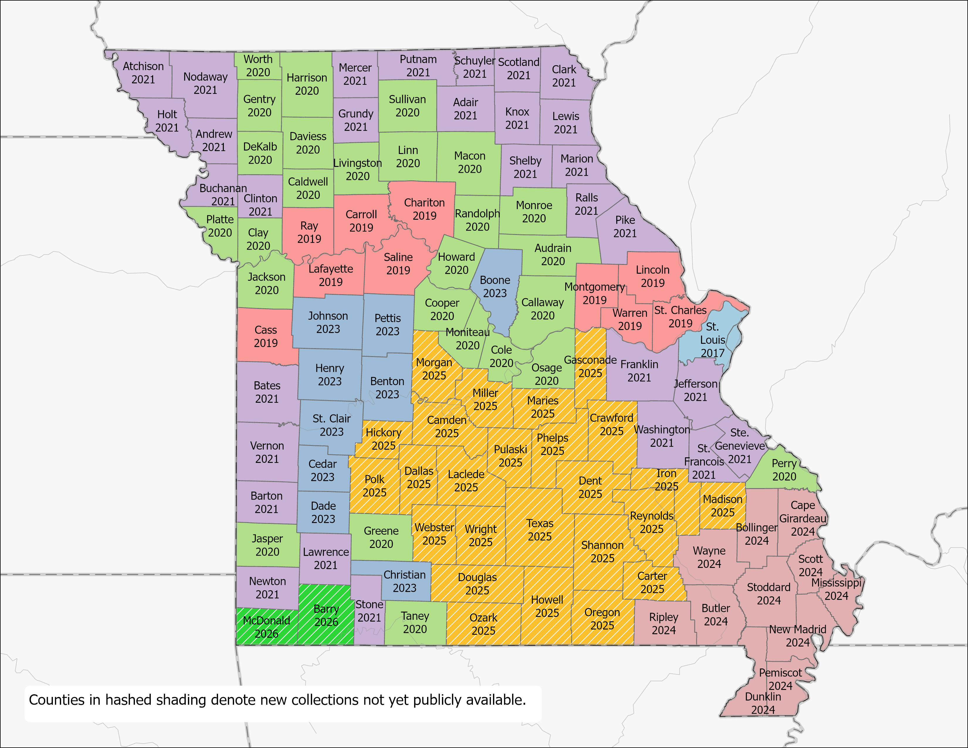
Statewide Imagery Project![]()
The state contract has been designed for local government; contractors have been pre-qualified allowing state and local government to obtain bids from each contractor without having to go through the Request for Proposals (RFP) process. For details please visit www.flymoimagery.com
March 7, 2023 State-wide Imagery Program Update
View Webinar Recording
LiDAR Status in Missouri
LiDAR and Elevation Derived Hydrography Project Dashboard, 2023